Meteorological and oceanographic (met-ocean) data supplied by the South African Weather Service played an integral part in the recent and successful Endurance 22 expedition.
by Marc de Vos, Senior Scientist, South African Weather Service (SAWS) Marine Research Unit.
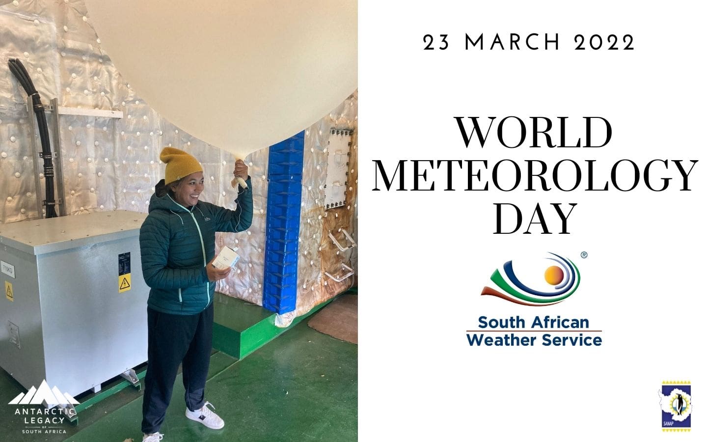
Carla-Louise Ramjukadh preparing to deploy a radiosonde (weather balloon). Find out more about a radiosonde – check out this video (click here).
The Endurance 22 expedition has returned from the Weddell Sea aboard the S.A. Agulhas II, having successfully located and surveyed the wreck of Sir Ernest Shackleton’s legendary Endurance. For the safety of any maritime activity, information about the environmental conditions is important. Mariners constantly evaluate factors such as sea-state (the combined effect of wind and waves on the surface of the ocean), tides, and surface currents, all of which affect the navigability of the vessel. For highly specialised undertakings, this requirement becomes particularly acute. To assist, the South African Weather Service (SAWS) sent two scientists from its Marine Research Unit to provide meteorological and oceanographic (met-ocean) support to the expedition.
The first challenge associated with a voyage to the Weddell Sea is the transit from Cape Town, through the south Atlantic and the Southern Ocean. These ocean areas are characterised by a steady procession of midlatitude cyclones; storms that might be up to 2,000 km in diameter, bringing strong winds, high seas, and powerful underlying ocean currents. These are the phenomena behind the nicknames for the latitudinal bands through which the S.A. Agulhas II needed to transit; the “Roaring Forties”, “Furious Fifties” and “Screaming Sixties”. In particular, the Southern Ocean is widely regarded as the roughest on the planet. This is largely due to the lack of land boundaries to break the acceleration of the ocean’s surface by the wind. Careful planning is required to thread a route through the storms, themselves moving and morphing, and the high seas which lag behind them. This process (sometimes more of an art!) is a fine balance between speed, efficiency, and risk-limitation, and the SAWS team on board worked closely with the ship’s officers to determine the most suitable route to the search area. It is a challenging but exciting task. We use a mix of data from numerical models, free-drifting ocean instruments and satellites, and algorithms that assist to process these data. Ultimately, the experience of the ship’s officers and the exchange of information between scientists and navigators remain key in balancing the myriad of competing factors.
Upon arrival in the sea ice, different challenges arise. The sea ice might be up to 4 metres thick, with an average of around 1.5 m, and covers the search area entirely. A process of constant ice-breaking, repositioning, drifting with the ice, and deploying the autonomous underwater vehicles (AUVs) to scan the sea bed begins (read more about these vehicles here). Whilst surveying the ship drifts with the ice, but the search area on the sea bed does not, and therefore it is vital to anticipate wind and tidal shifts such that the drift can be predicted and deployment of the AUVs planned accordingly. SAWS scientists worked closely to support the highly skilled sea ice specialists from Drift + Noise Polar Services to provide supplementary information of this nature.
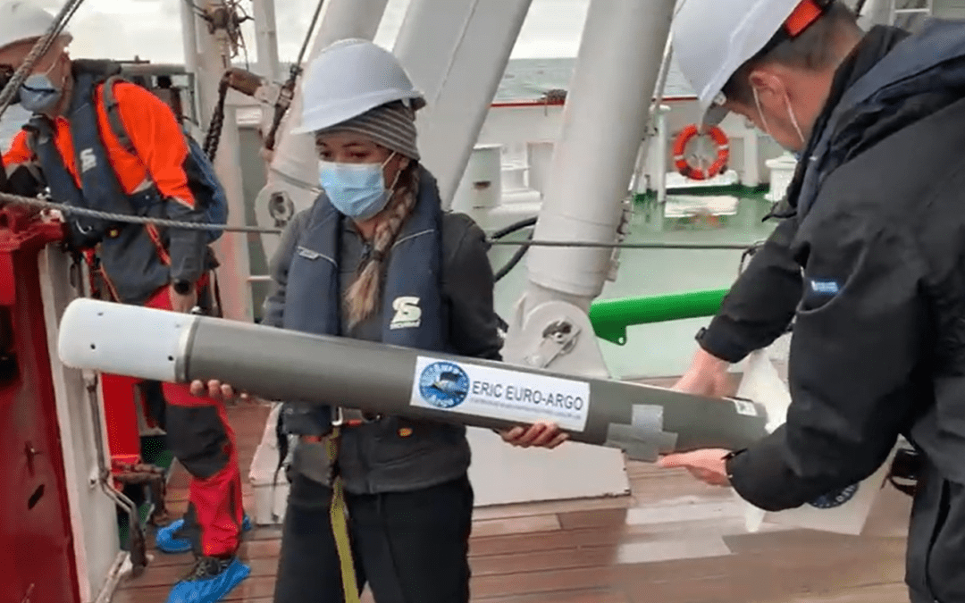
Prediction and analysis are not the only tasks for met-ocean scientists on board. Throughout the voyage, regular weather/ocean observations were performed and a range of meteorological instruments was deployed. These included Argo floats (see image above), surface velocity program (SVP) weather buoys, Sofar Ocean Wave Spotter buoys, and atmospheric radiosondes. These instruments drift freely in the ocean (or rise through the atmosphere, in the case of the radiosonde), collecting and transmitting data in an-otherwise data sparse region. Data are processed and fed to global numerical weather/ocean prediction models to improve their predictions via a process called data assimilation. Generally, the more data supplied to models, the better their performance. In many cases, measurements from these instruments are also available in real-time, providing an excellent means to onboard scientists by which to “ground-truth” ocean/weather predictions. Finally, data are archived in climate databases, for future use by climate change researchers.
Being able to play a small role in the success of Endurance 22 feels like a career-defining moment. A historic event of this scale, having taken place in so beautiful and dramatic an environment, is a uniquely rewarding experience. I am humbled to have been asked to participate and immensely grateful to the leadership of the expedition. I am also thankful to fellow expedition members and particularly my on-board colleague, Carla-Louise Ramjukadh, along with shore-based colleagues Tania Daniels, Michael Barnes and Tammy Morris for their tireless support behind the scenes. Even in the modern world, where almost everything can be navigated digitally, the fundamental effects of meteorology and oceanography continue to affect every human on the planet. Young people looking for where to apply their skills and ambitions should be encouraged by this, and the incredible opportunities which our science often provides.
Text by Marc de Vos, Senior Scientist, South African Weather Service (SAWS) Marine Research Unit. Edited by Anche Louw, Antarctic Legacy of South Africa, 23 March 2022