by Ria Olivier | Feb 27, 2023 | Announcement, Gough Island, News, Newsletters>Gough Island Newsletters, Overwintering Team, SANAP, Stations, Team member, Team Photo
The 68th Gough Island Overwintering Team has published their first newsletter – The Bunting – January 2023 (Issue 1).
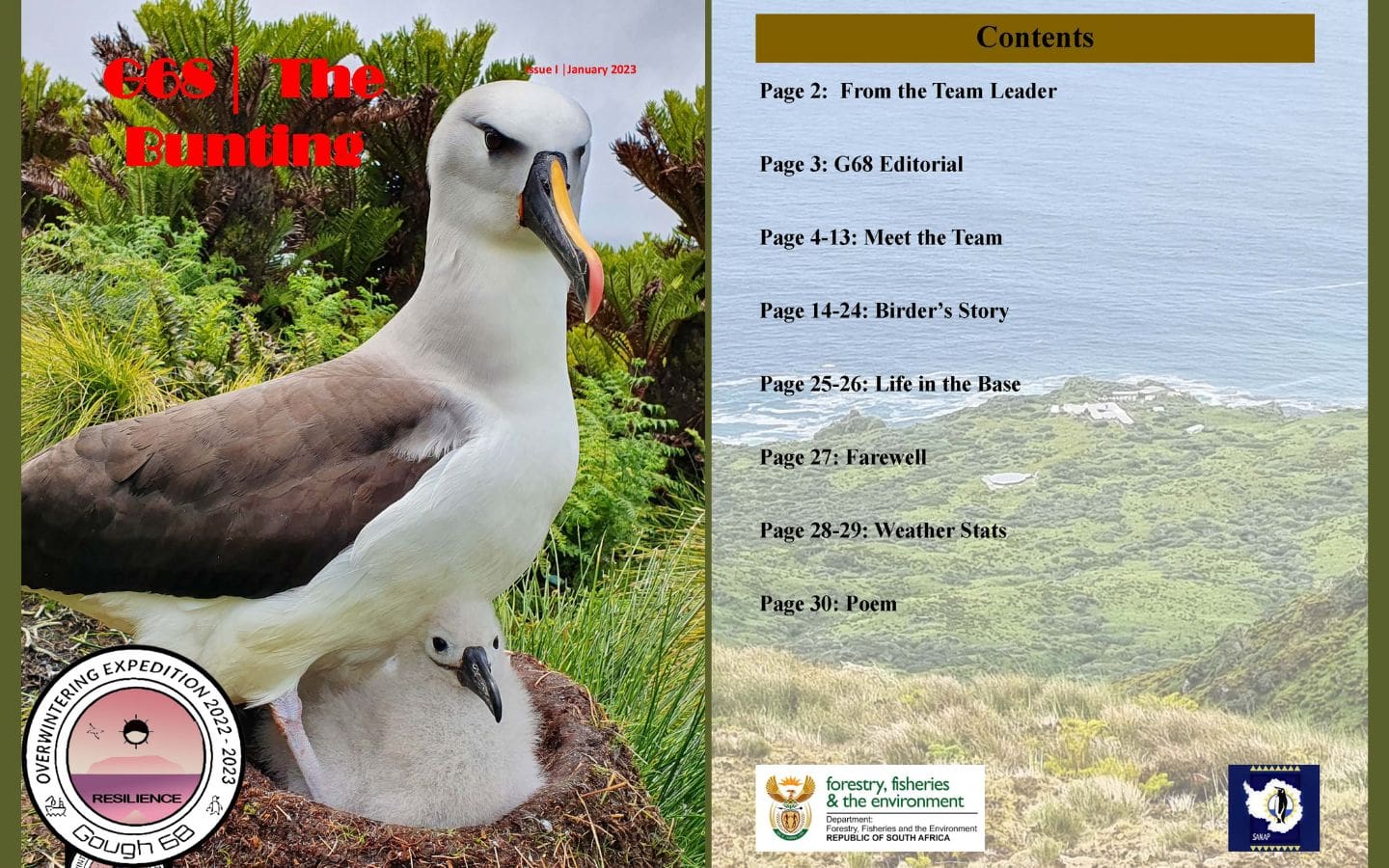
In this edition:
- Letter from the team leader
- Words from the G68 Bunting editorial team
- Meet the G68 team
- Birder’s Stories
- Life in the Base (birthday celebration)
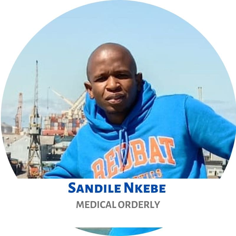
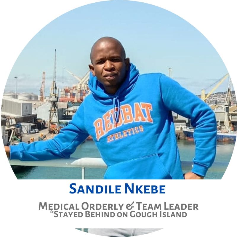
- Farewell to Sandile (Medical Orderly of G67 who had to stay behind until a new medic is sent to Gough)
- Weather Stats (October, November, December 2022)
- To end the newsletter; a poem about an Albatross chick.
Click here to download/view the newsletter!
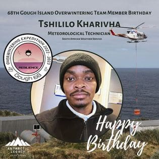
Birthdays celebrated by G68 so far:
Anche Louw, South African Polar Research Infrastructure (Data, Products & Society Node), 27 February 2023.
by Ria Olivier | Nov 10, 2022 | Antarctica, Environment, Gough Island, International Days, Marion Island, News, Research, SA Agulhas II, Science, Southern Ocean, sub-Antarctic
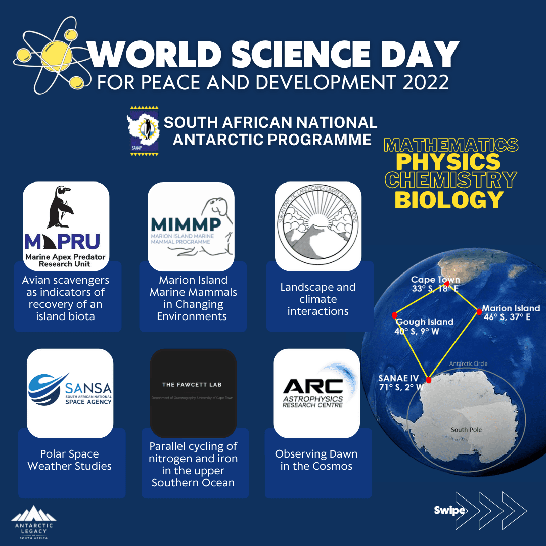
World Science Day for Peace and Development is coordinated each year by UNESCO on 10 November.
The theme of World Science Day for Peace and Development is Basic Sciences for Sustainable Development. This day is being celebrated within the International Year of Basic Sciences for Sustainable Development, which kicked off on 8 July 2022 (UNESCO).
World Science Day for Peace and Development aims to build a bridge between science and society. This should be an encouragement to all scientific programmes to create an open line for communication between scientists and the public. The public needs to be informed about polar research as “the polar regions are extremely important and connected to the rest of the planet. The polar regions are essential for the health and future of the fantastic planet earth” (European Polar Board Executive Secretary, Dr Renuka Badhe).
Keep an eye out for more information on the Antarctic Season Launch 2022 – providing a platform for discussions between the SANAP scientific community and the public.
Scientific projects within the South African National Antarctic Programme (SANAP) are based on basic sciences (Mathematics, Physics, Chemistry, and Biology). Below we point out some of these scientific projects funded by the National Research Foundation (SANAP-Funding).
See below a list of all the research projects funded by the NRF-SANAP. These projects will be funded until the end of 2023.
Researchers previously involved in SANAP and those new to Antarctic research from universities not previously involved in SANAP are encouraged to put in a project proposal once the new cycle for applications opened.
View the current NRF-SANAP projects and previous NRF-SANAP projects here.
Anche Louw, Antarctic Legacy of South Africa, 10 November 2022.
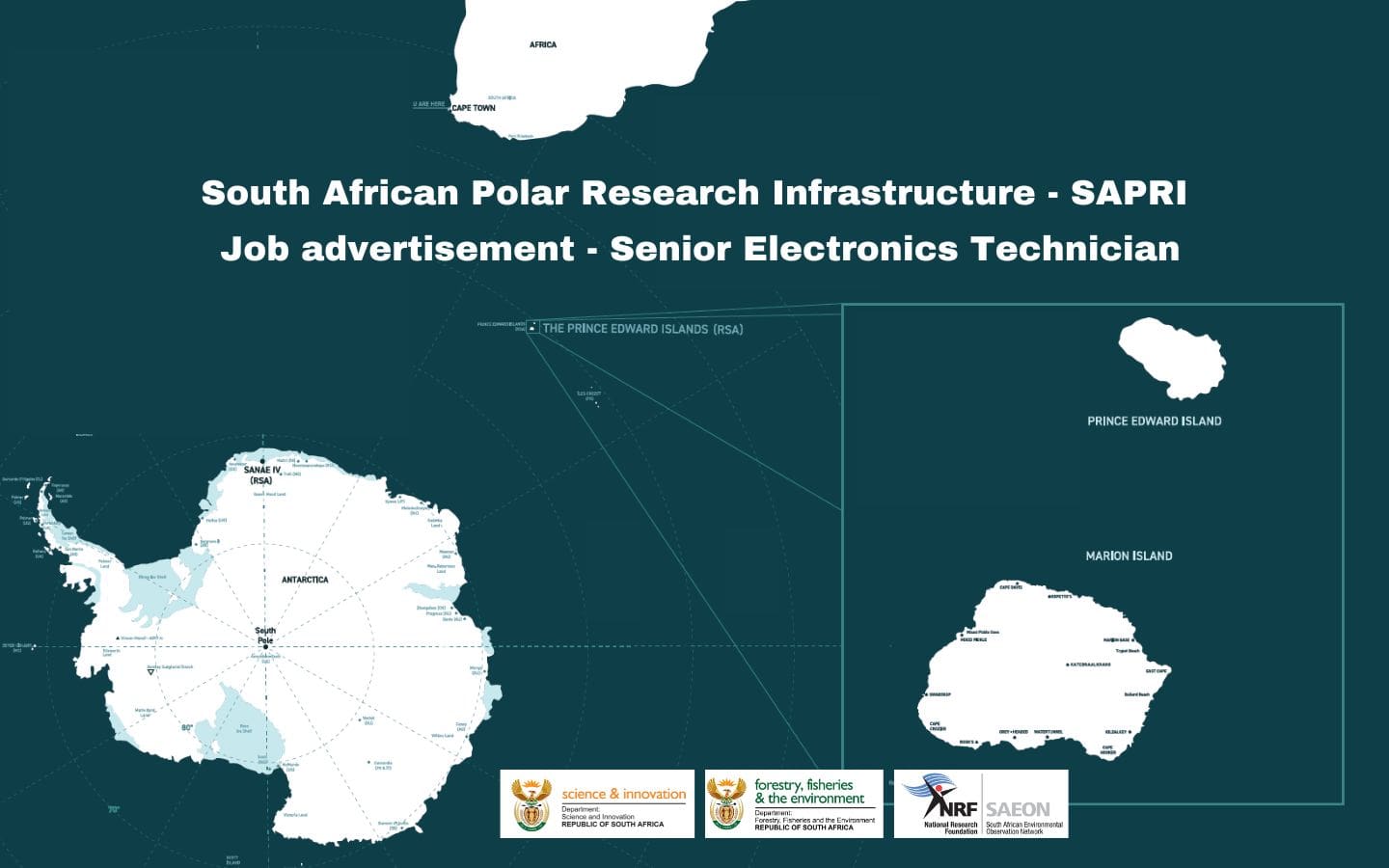
by Ria Olivier | Nov 2, 2022 | Announcement, Antarctica, Gough Island, Jobs, Marion Island, Prince Edward Island, Prince Edward Islands, SA Agulhas II, SA Polar Research Infrastructure, SANAE, SANAP, SAPolarRI, SAPRI, Science, Southern Ocean, sub-Antarctic
As per job advertisement:
The South African Environmental Observation Network (SAEON) is a research platform funded by the Department of Science and Innovation (DSI) and managed by the National Research Foundation (NRF).
SAEON is mandated to establish and manage long-term environmental observatories; maintain reliable long-term environmental data sets; promote access to data for research and/or informed decision making; and contribute to capacity building.
This position is supported by the Department of Science and Innovation’s South African Polar Research Infrastructure (SAPRI) programme and will be based in Cape Town.
A Senior Electronics Technician to provide technical and logistic support for the SAPRI programme’s various research and long-term monitoring activities in the offshore marine and Southern Ocean, sub-Antarctic Islands and Antarctica, conducted onboard South African and international research vessels.
Application Closing Date: 16 November 2022
Click here to view the position advert.
Read more about SAPRI:
South African Polar Research Infrastructure (SAPRI): Feedback and start of the Preparatory Phase
Anche Louw, Antarctic Legacy of South Africa
by Ria Olivier | Sep 20, 2022 | Announcement, Gough Island, Legacy, News, Overwintering Team, SA Agulhas II, SANAP, Stations, Team Photo
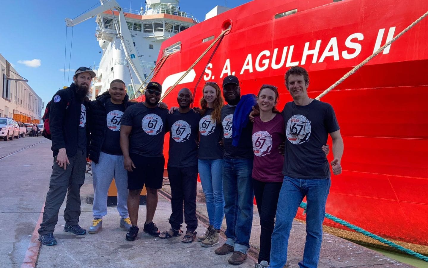
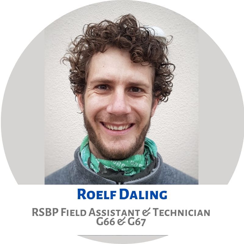
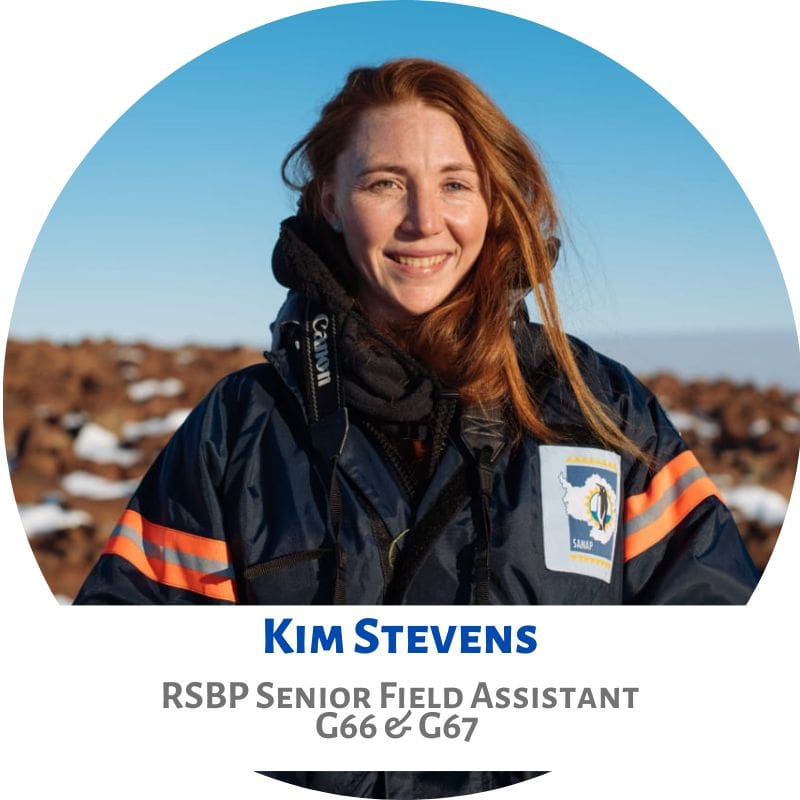
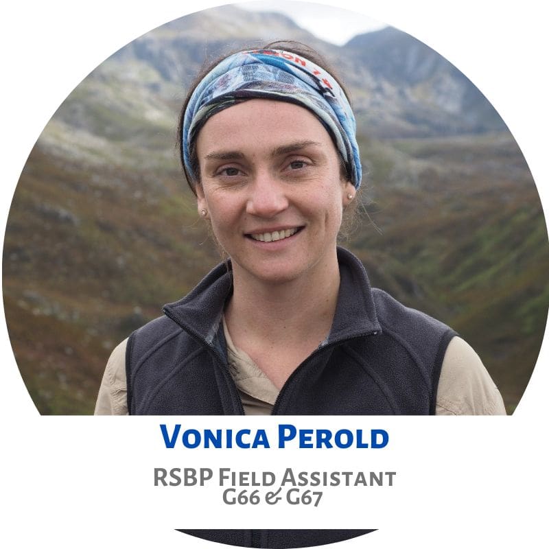
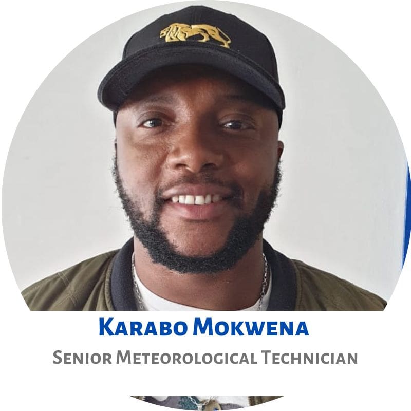
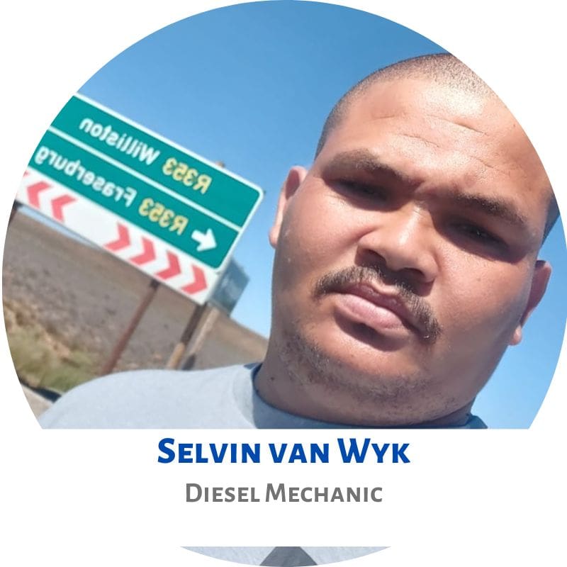
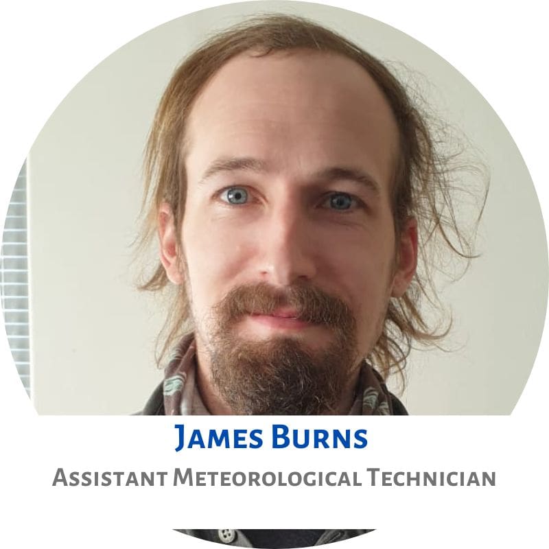
L-R: James Burns, Selvin van Wyk, Karabo Mokwena, Nkosi Madama, Kim Stevens, Peter Chuku, Vonica Perold and Roelf Daling.
The 67th Gough Island Overwintering Team has returned to Cape Town. Two members of this team stayed behind on Gough Island.
Departure to Gough Island: 15 September 2021
Disembarked at East Pier: 20 September 2022
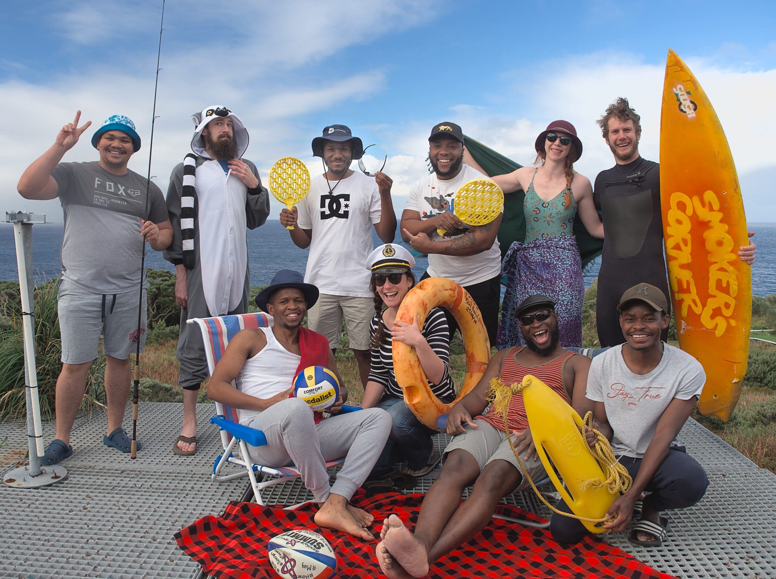
Gough 67
The 67th Gough Island Overwintering Team – Offical Team Photo
This image was taken during midwinter.
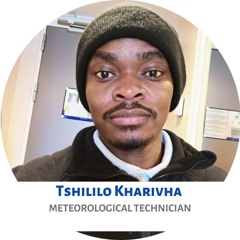
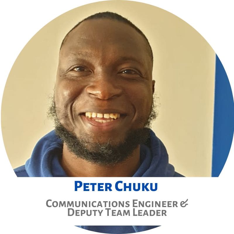
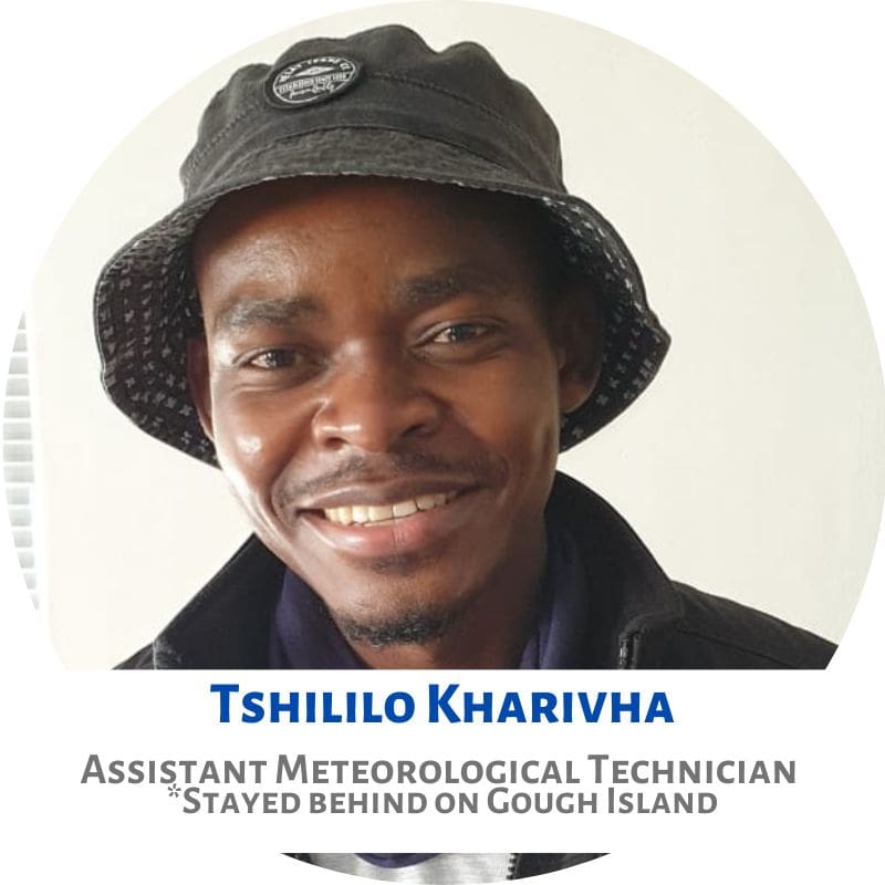
Back (L-R): Selvin van Wyk, James Burns, Nkosi Madama, Karabo Mokwena, Kim Stevens, Roelf Daling; (front) Sandile Nkebe, Vonica Perold, Peter Chuku and Tshililo Kharivha.
Links to relevant articles:
Check out all the G67 newsletters produced!
Team photo supplied by: Roelf Daling
Anche Louw, Antarctic Legacy of South Africa, 20 September 2022
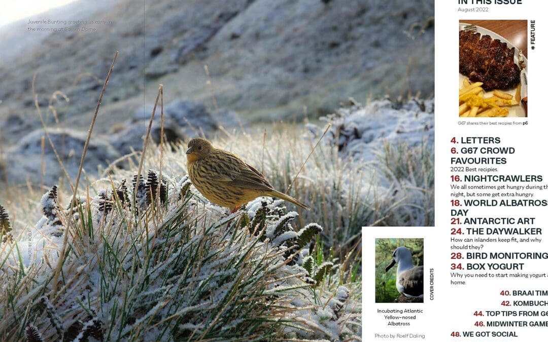
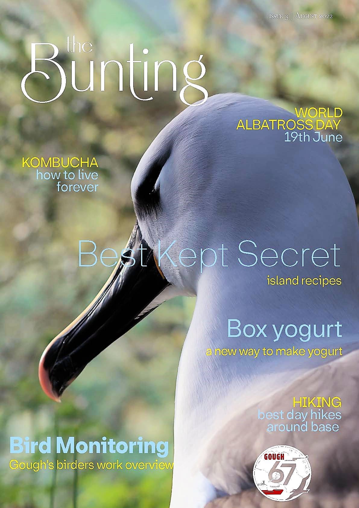
by Ria Olivier | Sep 8, 2022 | Announcement, Gough Island, Newsletters>Gough Island Newsletters, Overwintering Team, SANAP
“It is with mixed emotions that we send these final greetings from the G67 team! The time has come to present our ultimate Bunting newsletter before handing over the reins to the next editor(s) who will be responsible for introducing the resilient members of G68.” – Editor Gough Bunting.
Read the final Newsletter form the Gough67 Overwintering Team. Inside this issue:
“Goodbye Gough Island and thank you for everything.” – Sandile Nkebe (Team
leader of G67)
by Ria Olivier | Aug 25, 2022 | Announcement, Current Event, Gough Island, News, Overwintering Team, Stations, Team member, Team Photo, Tristan da Cunha
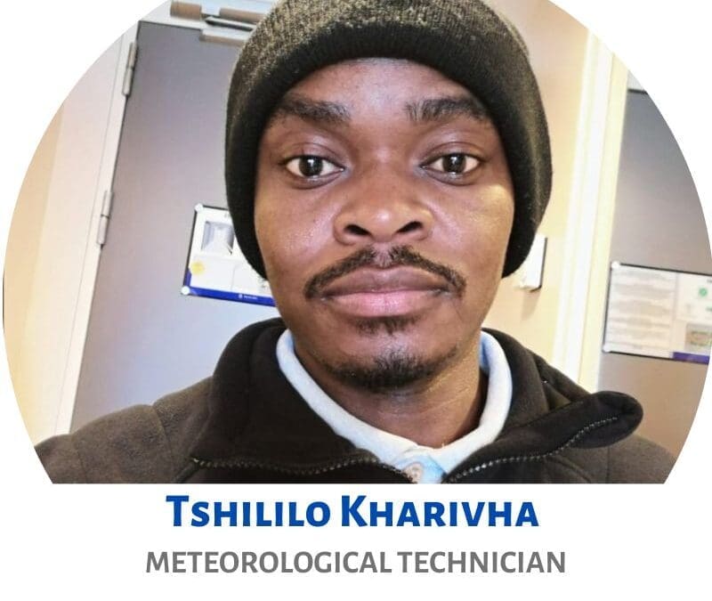
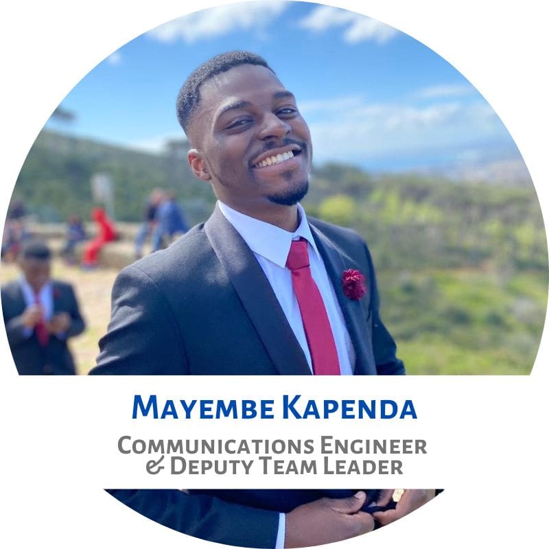
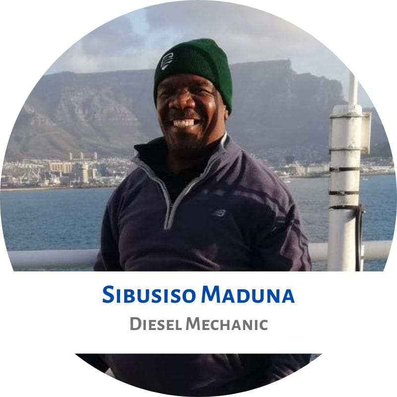
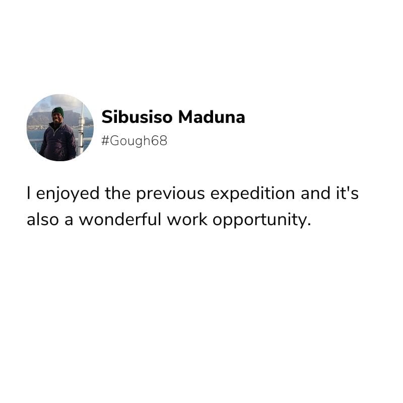
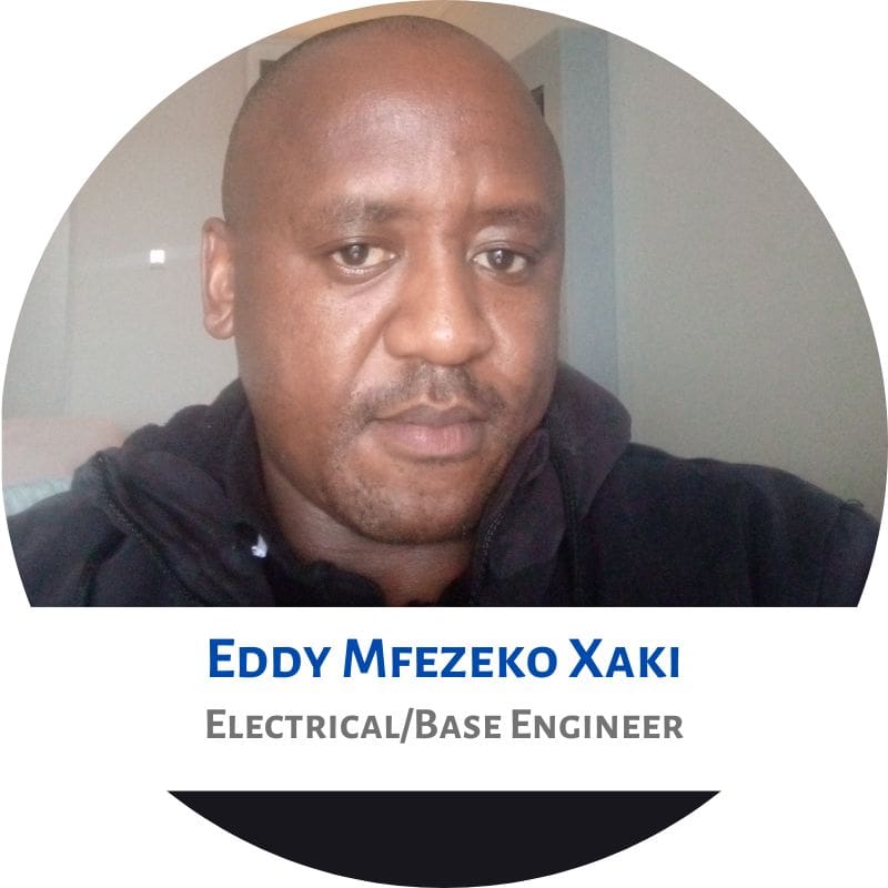
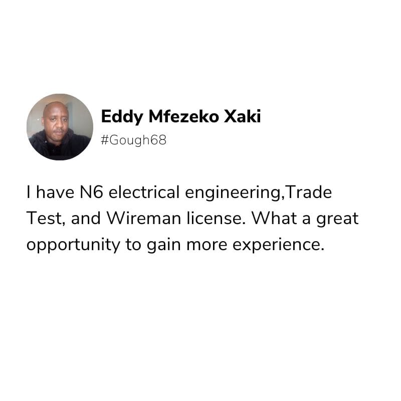
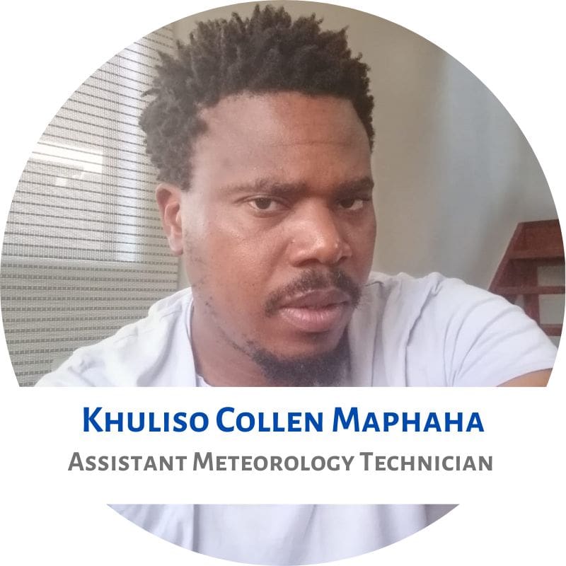
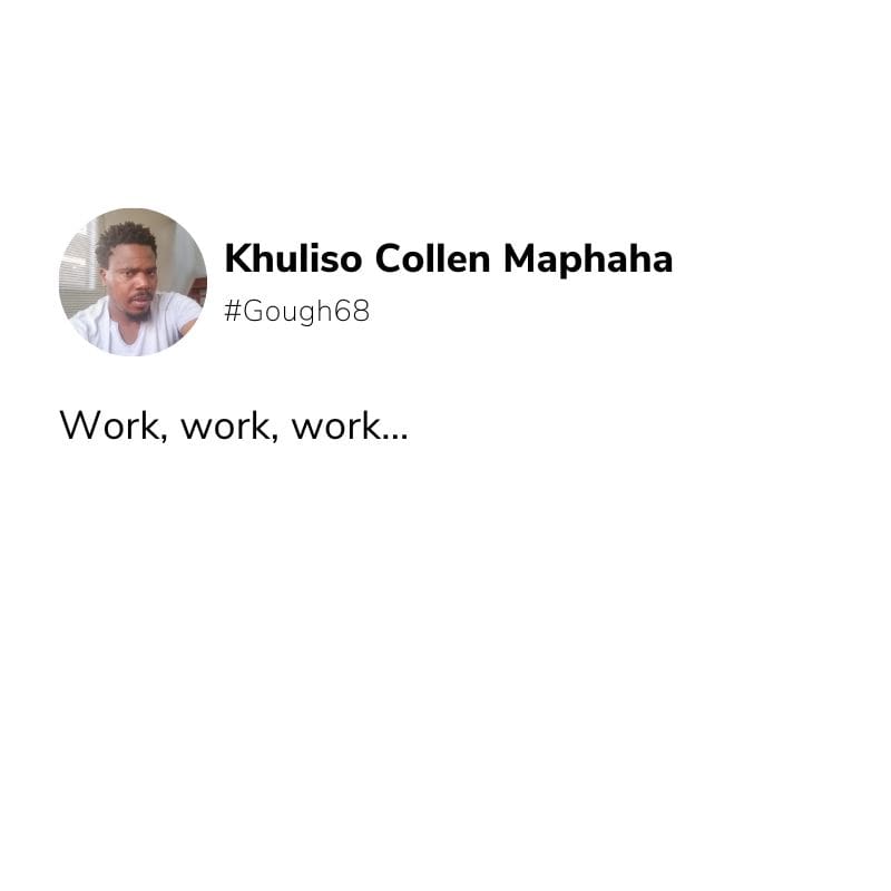
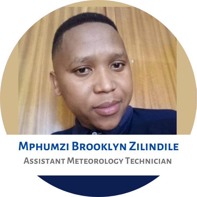
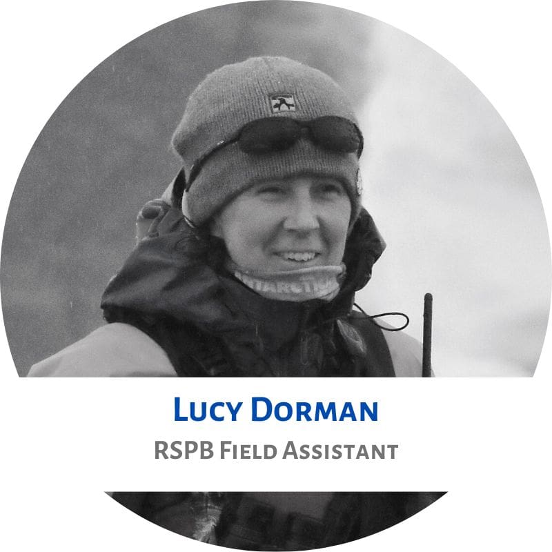
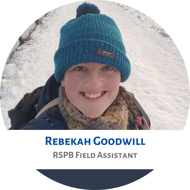
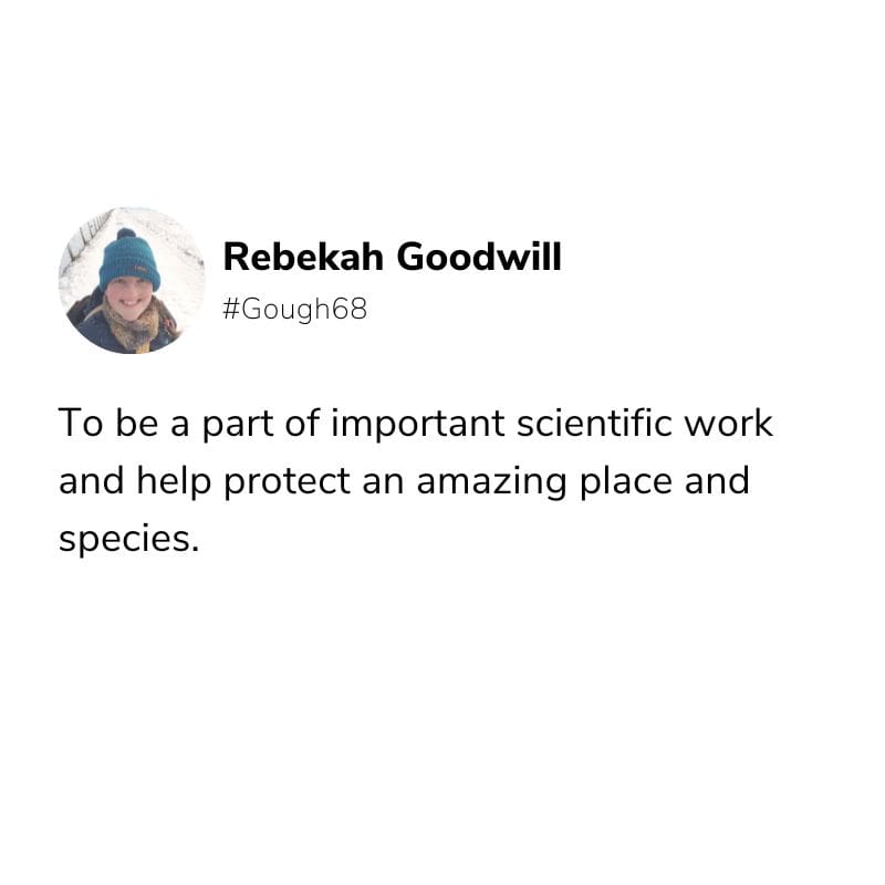
G68 Team (Left to Right): Lucy Dorman, Joyfull Ntobeko Gaju (removed from the team and replaced with G67 Medic, Sandile Nkebe), Philani Siyabonga Ngcobo (removed from the team and replaced with G67 Assistant Meteorological Technician, Tshililo Kharivha), Sibusiso Maduna, Rebekah Goodwill, Mphumzi Brooklyn Zilindile, Eddy Mfezeko Xaki, Khuliso Collen Maphaha, Mayembe Kapenda.
On 20 August 2022, the S.A. Agulhas II departed to Gough Island, via Tristan da Cunha. They will soon arrive at their new home, where they will be living for the next approximately 13 months. The G68 team will replace the G67 team.
68th Gough Island Overwintering Team (G68)
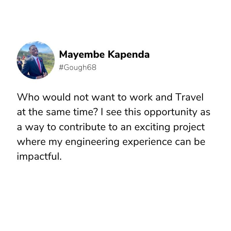
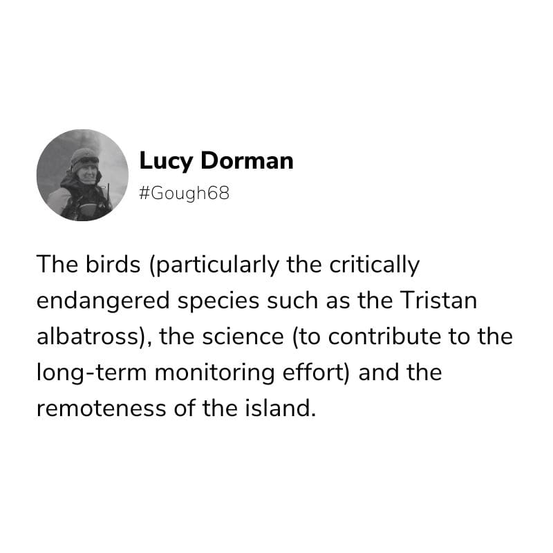
We asked the team members why they applied to be part of G68?
Two team members stayed behind from G67. The Medical Orderly, Sandile, will be replaced at a later stage and Tshililo will stay on for the year as part of G68.
Anche Louw, Antarctic Legacy of South Africa, 25 August 2022, updated on 19 September 2022.


 “It is with mixed emotions that we send these final greetings from the G67 team! The time has come to present our ultimate Bunting newsletter before handing over the reins to the next editor(s) who will be responsible for introducing the resilient members of G68.” – Editor Gough Bunting.